Caltrans Cameras for District 7 Real Time Traffic Cameras
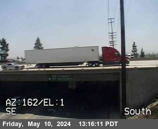
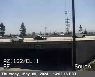
SR-213 near San Pedro in Los Angeles County
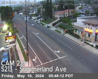


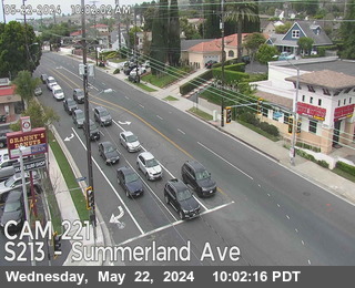
District: 7 Camera ID: 221
Location: SR-213 : Summerland Ave
View on Google Maps
Direction: North
Elevation: 351
Location: SR-213 : Summerland Ave
View on Google Maps
Direction: North
Elevation: 351
SR-47 near Long Beach in Los Angeles County
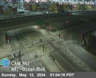


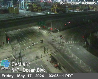
District: 7 Camera ID: 961
Location: SR-47 : (957) Ocean Blvd
View on Google Maps
Direction: North
Elevation: 65
Location: SR-47 : (957) Ocean Blvd
View on Google Maps
Direction: North
Elevation: 65
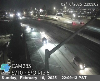
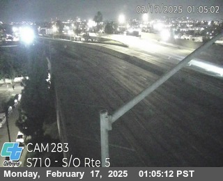
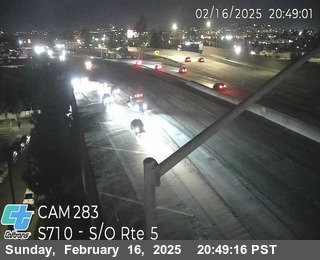
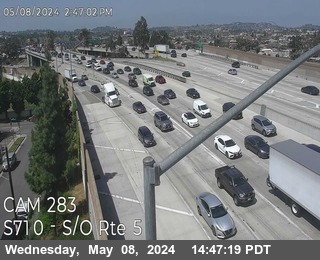
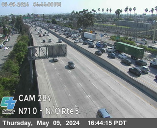
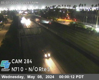
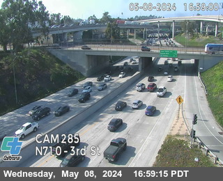
I-710 near Long Beach in Los Angeles County
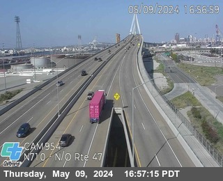


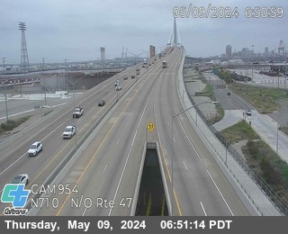
District: 7 Camera ID: 954
Location: I-710 : North of SR-47
View on Google Maps
Direction: North
Elevation: 29
Location: I-710 : North of SR-47
View on Google Maps
Direction: North
Elevation: 29
SR-47 near Long Beach in Los Angeles County
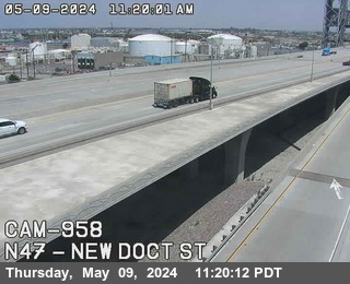


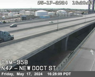
District: 7 Camera ID: 958
Location: SR-47 : New Dock St
View on Google Maps
Direction: North
Elevation: 16
Location: SR-47 : New Dock St
View on Google Maps
Direction: North
Elevation: 16
SR-47 near Long Beach in Los Angeles County
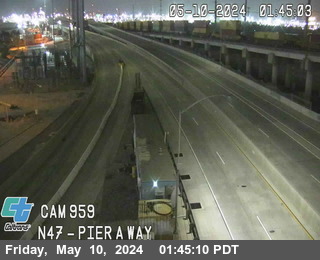


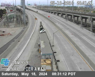
District: 7 Camera ID: 962
Location: SR-47 : (959) Pier AWay
View on Google Maps
Direction: North
Elevation: 95
Location: SR-47 : (959) Pier AWay
View on Google Maps
Direction: North
Elevation: 95
I-710 near Long Beach in Los Angeles County
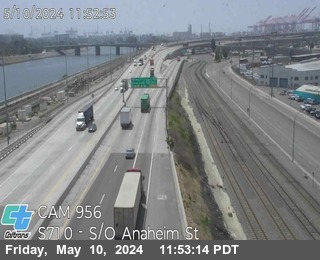


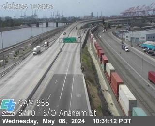
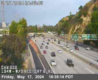
District: 7 Camera ID: 956
Location: I-710 : South of Anaheim St
View on Google Maps
Direction: South
Elevation: 32
Location: I-710 : South of Anaheim St
View on Google Maps
Direction: South
Elevation: 32
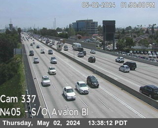
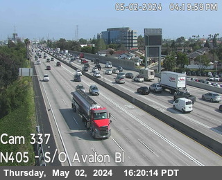
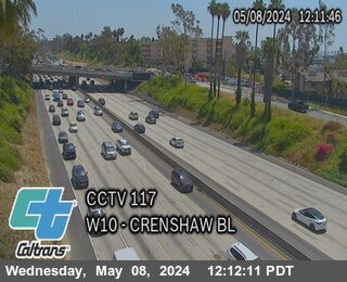
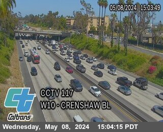
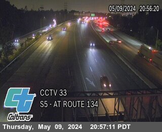
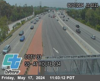
I-405 near Long Beach in Los Angeles County
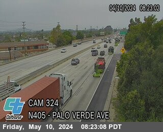


District: 7 Camera ID: 324
Location: I-405 : Palo Verde Ave
View on Google Maps
Direction: North
Elevation: 32
Location: I-405 : Palo Verde Ave
View on Google Maps
Direction: North
Elevation: 32
I-710 near Long Beach in Los Angeles County
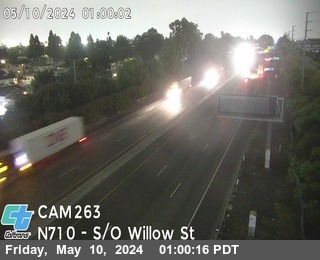


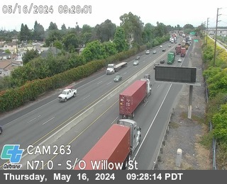
District: 7 Camera ID: 263
Location: I-710 : South of Willow Street
View on Google Maps
Direction: North
Elevation: 19
Location: I-710 : South of Willow Street
View on Google Maps
Direction: North
Elevation: 19
SR-1 near Torrance in Los Angeles County
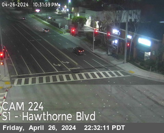


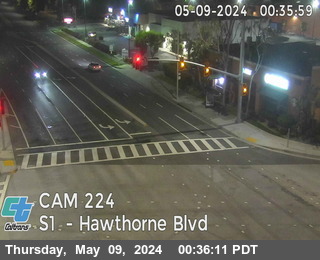
District: 7 Camera ID: 224
Location: SR-1 : Hawthorne Blvd
View on Google Maps
Direction: South
Elevation: 114
Location: SR-1 : Hawthorne Blvd
View on Google Maps
Direction: South
Elevation: 114
I-710 near Long Beach in Los Angeles County
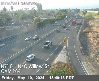


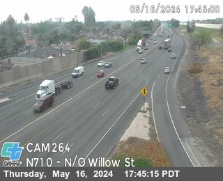
District: 7 Camera ID: 264
Location: I-710 : North of Willow St
View on Google Maps
Direction: North
Elevation: 36
Location: I-710 : North of Willow St
View on Google Maps
Direction: North
Elevation: 36
I-405 near Long Beach in Los Angeles County
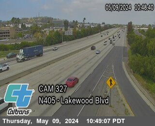


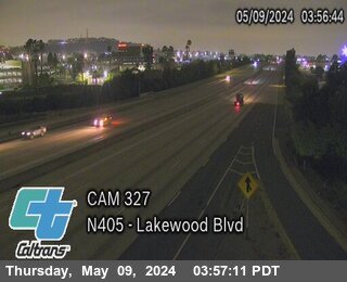
District: 7 Camera ID: 327
Location: I-405 : Lakewood Blvd
View on Google Maps
Direction: North
Elevation: 75
Location: I-405 : Lakewood Blvd
View on Google Maps
Direction: North
Elevation: 75
I-605 near Long Beach in Los Angeles County
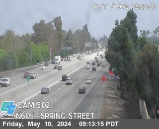


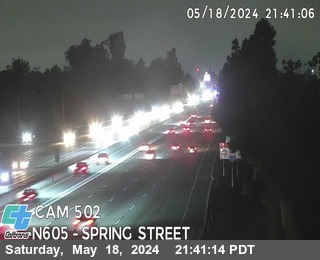
District: 7 Camera ID: 502
Location: I-605 : Spring St
View on Google Maps
Direction: North
Elevation: 36
Location: I-605 : Spring St
View on Google Maps
Direction: North
Elevation: 36
I-605 near Long Beach in Los Angeles County
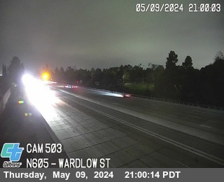


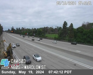
District: 7 Camera ID: 503
Location: I-605 : Wardlow St
View on Google Maps
Direction: North
Elevation: 39
Location: I-605 : Wardlow St
View on Google Maps
Direction: North
Elevation: 39
I-405 near Carson in Los Angeles County
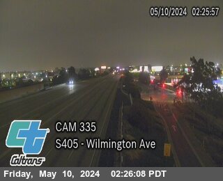


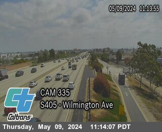
District: 7 Camera ID: 335
Location: I-405 : Wilmington Ave
View on Google Maps
Direction: South
Elevation: 39
Location: I-405 : Wilmington Ave
View on Google Maps
Direction: South
Elevation: 39
I-605 near Long Beach in Los Angeles County
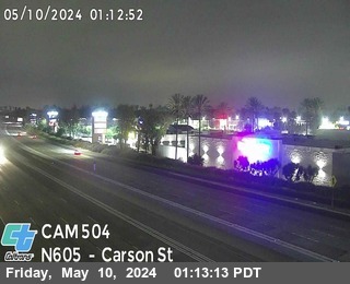


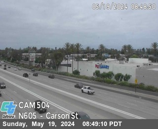
District: 7 Camera ID: 504
Location: I-605 : Carson St Off-Ramp
View on Google Maps
Direction: North
Elevation: 49
Location: I-605 : Carson St Off-Ramp
View on Google Maps
Direction: North
Elevation: 49
SR-107 near Torrance in Los Angeles County
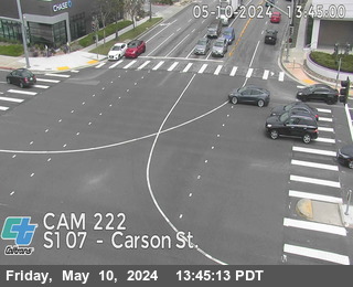


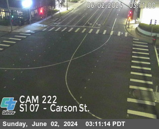
District: 7 Camera ID: 222
Location: SR-107 : Carson Blvd
View on Google Maps
Direction: South
Elevation: 101
Location: SR-107 : Carson Blvd
View on Google Maps
Direction: South
Elevation: 101
I-710 near xxx in Los Angeles County
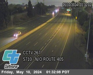


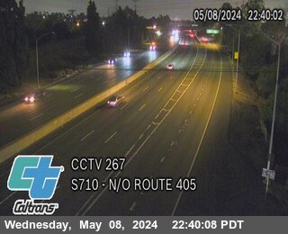
District: 7 Camera ID: 267
Location: I-710 : North of I-405
View on Google Maps
Direction: South
Elevation: -1
Location: I-710 : North of I-405
View on Google Maps
Direction: South
Elevation: -1
I-405 near Carson in Los Angeles County


SR-107 near Torrance in Los Angeles County
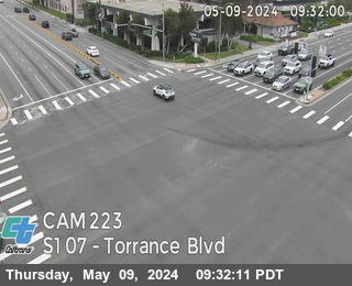


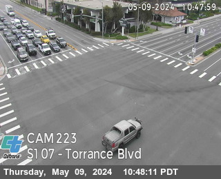
District: 7 Camera ID: 223
Location: SR-107 : Torrance Blvd
View on Google Maps
Direction: South
Elevation: 114
Location: SR-107 : Torrance Blvd
View on Google Maps
Direction: South
Elevation: 114
I-605 near Lakewood in Los Angeles County
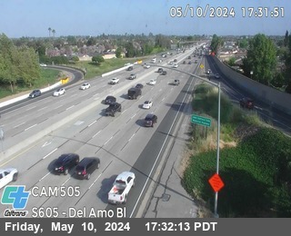


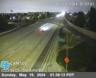
District: 7 Camera ID: 505
Location: I-605 : Del Amo Blvd On-Ramp
View on Google Maps
Direction: South
Elevation: 59
Location: I-605 : Del Amo Blvd On-Ramp
View on Google Maps
Direction: South
Elevation: 59
I-405 near Gardena in Los Angeles County
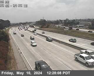


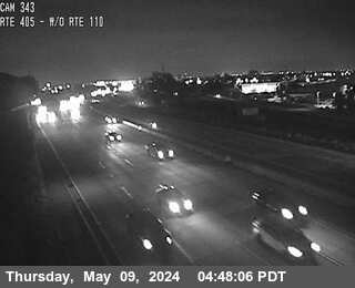
District: 7 Camera ID: 343
Location: I-405 : West of I-110
View on Google Maps
Direction: North
Elevation: 72
Location: I-405 : West of I-110
View on Google Maps
Direction: North
Elevation: 72
I-605 near Cerritos in Los Angeles County
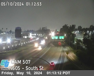


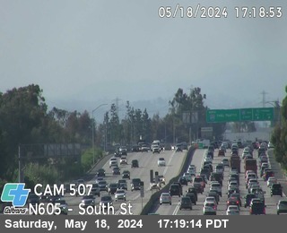
District: 7 Camera ID: 507
Location: I-605 : South St On-Ramp
View on Google Maps
Direction: North
Elevation: 72
Location: I-605 : South St On-Ramp
View on Google Maps
Direction: North
Elevation: 72
I-710 near Long Beach in Los Angeles County
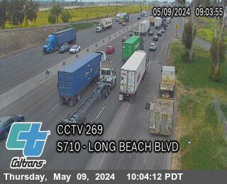


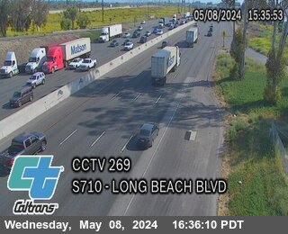
District: 7 Camera ID: 269
Location: I-710 : Long Beach Blvd
View on Google Maps
Direction: South
Elevation: 65
Location: I-710 : Long Beach Blvd
View on Google Maps
Direction: South
Elevation: 65
SR-1 near Hermosa Beach in Los Angeles County
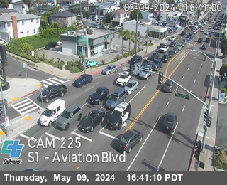


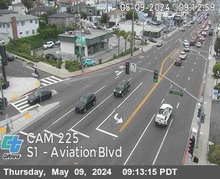
District: 7 Camera ID: 225
Location: SR-1 : Aviation Blvd
View on Google Maps
Direction: South
Elevation: 98
Location: SR-1 : Aviation Blvd
View on Google Maps
Direction: South
Elevation: 98
I-605 near Cerritos in Los Angeles County
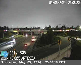


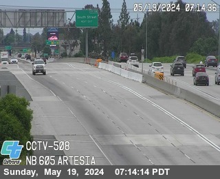
District: 7 Camera ID: 508
Location: I-605 : South of SR-91
View on Google Maps
Direction: North
Elevation: 85
Location: I-605 : South of SR-91
View on Google Maps
Direction: North
Elevation: 85
I-710 near Lynwood in Los Angeles County
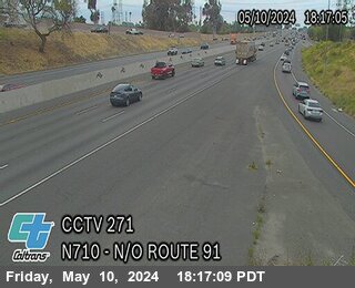


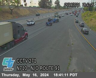
District: 7 Camera ID: 960
Location: I-710 : (271) N/O Route 91
View on Google Maps
Direction: North
Elevation: 95
Location: I-710 : (271) N/O Route 91
View on Google Maps
Direction: North
Elevation: 95
I-605 near Cerritos in Los Angeles County
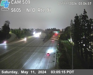


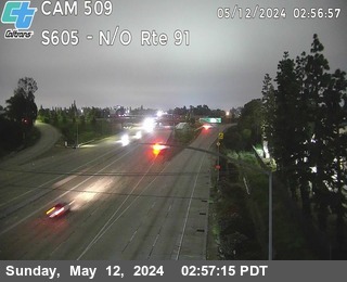
District: 7 Camera ID: 509
Location: I-605 : North of SR-91
View on Google Maps
Direction: South
Elevation: 82
Location: I-605 : North of SR-91
View on Google Maps
Direction: South
Elevation: 82
SR-1 near Manhattan Beach in Los Angeles County
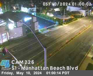


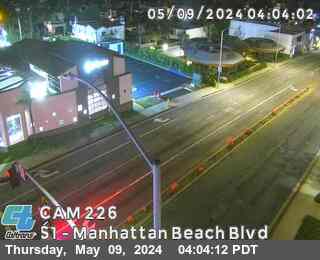
District: 7 Camera ID: 226
Location: SR-1 : Manhattan Beach Blvd
View on Google Maps
Direction: South
Elevation: 150
Location: SR-1 : Manhattan Beach Blvd
View on Google Maps
Direction: South
Elevation: 150
I-605 near Norwalk in Los Angeles County
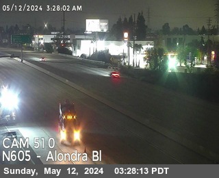
District: 7 Camera ID: 510
Location: I-605 : Alondra Blvd On-Ramp
View on Google Maps
Direction: North
Elevation: 85
Location: I-605 : Alondra Blvd On-Ramp
View on Google Maps
Direction: North
Elevation: 85
I-110 near Gardena in Los Angeles County
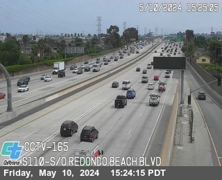


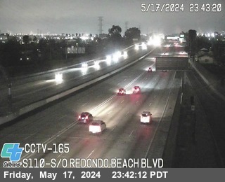
District: 7 Camera ID: 967
Location: I-110 : (165) SO Redondo Beach Blvd
View on Google Maps
Direction: South
Elevation: 95
Location: I-110 : (165) SO Redondo Beach Blvd
View on Google Maps
Direction: South
Elevation: 95
I-110 near Gardena in Los Angeles County
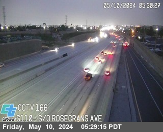


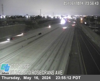
District: 7 Camera ID: 1003
Location: I-110 : (166) South Of Rosecrans Ave
View on Google Maps
Direction: South
Elevation: 95
Location: I-110 : (166) South Of Rosecrans Ave
View on Google Maps
Direction: South
Elevation: 95
I-605 near Norwalk in Los Angeles County
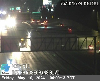


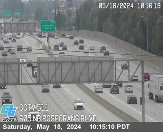
District: 7 Camera ID: 511
Location: I-605 : Rosecrans Ave
View on Google Maps
Direction: North
Elevation: 104
Location: I-605 : Rosecrans Ave
View on Google Maps
Direction: North
Elevation: 104
I-5 near Norwalk Park in Los Angeles County
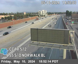


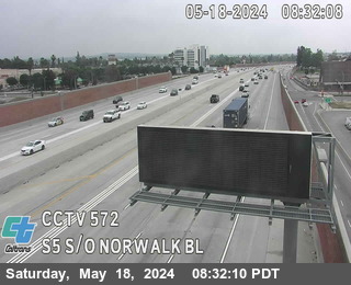
District: 7 Camera ID: 995
Location: I-5 : (572) S/O Norwalk Blvd
View on Google Maps
Direction: South
Elevation: 95
Location: I-5 : (572) S/O Norwalk Blvd
View on Google Maps
Direction: South
Elevation: 95
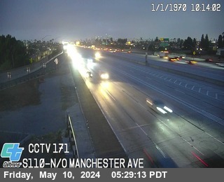
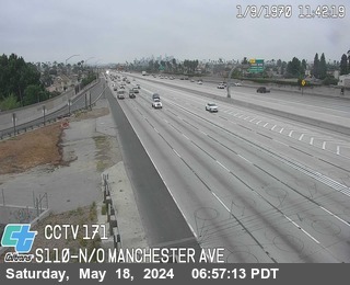
I-110 near Manchester Square in Los Angeles County


District: 7 Camera ID: 1014
Location: I-110 : (164) S/O El Segundo Blvd
View on Google Maps
Direction: South
Elevation: 95
Location: I-110 : (164) S/O El Segundo Blvd
View on Google Maps
Direction: South
Elevation: 95
I-110 near Vermont Knolls in Los Angeles County


District: 7 Camera ID: 1016
Location: I-110 : (167) SO El Segundo Blvd
View on Google Maps
Direction: South
Elevation: 95
Location: I-110 : (167) SO El Segundo Blvd
View on Google Maps
Direction: South
Elevation: 95
I-605 near Norwalk in Los Angeles County


I-710 near Lynwood in Los Angeles County
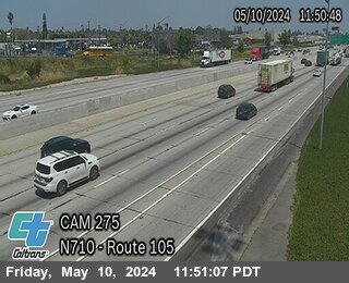


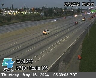
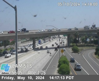
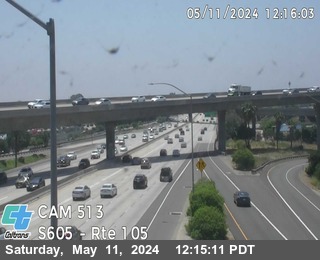
District: 7 Camera ID: 275
Location: I-710 : North of I-105
View on Google Maps
Direction: North
Elevation: 95
Location: I-710 : North of I-105
View on Google Maps
Direction: North
Elevation: 95
I-5 near Norwalk in Los Angeles County
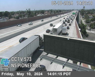


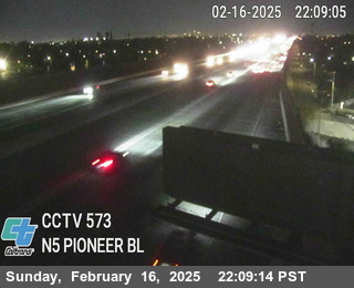
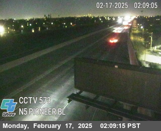
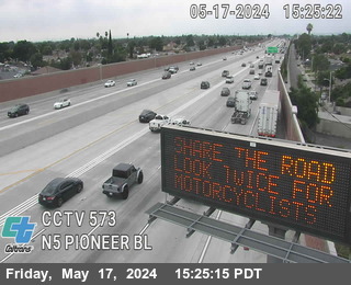
District: 7 Camera ID: 996
Location: I-5 : (573) Pioneer BL
View on Google Maps
Direction: South
Elevation: 150
Location: I-5 : (573) Pioneer BL
View on Google Maps
Direction: South
Elevation: 150
I-110 near Harbor Gateway North in Los Angeles County
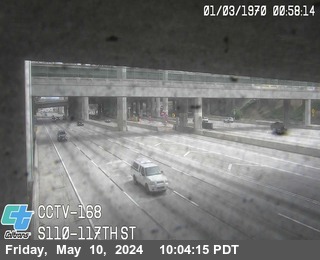


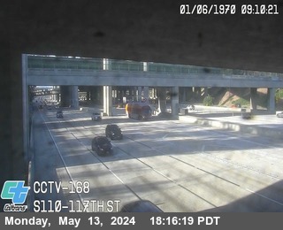
District: 7 Camera ID: 997
Location: I-110 : (168) 117th St
View on Google Maps
Direction: South
Elevation: 95
Location: I-110 : (168) 117th St
View on Google Maps
Direction: South
Elevation: 95
I-710 near Lynwood in Los Angeles County
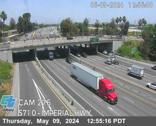


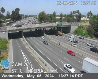
District: 7 Camera ID: 276
Location: I-710 : Southbound I-710 Imperial Hwy
View on Google Maps
Direction: South
Elevation: 104
Location: I-710 : Southbound I-710 Imperial Hwy
View on Google Maps
Direction: South
Elevation: 104
I-110 in Los Angeles County
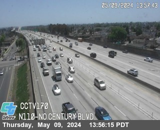


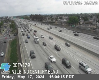
District: 7 Camera ID: 998
Location: I-110 : (170) North Of Century Blvd
View on Google Maps
Direction: North
Elevation: 95
Location: I-110 : (170) North Of Century Blvd
View on Google Maps
Direction: North
Elevation: 95
I-5 near Downey in Los Angeles County
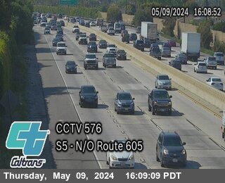


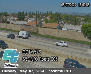
District: 7 Camera ID: 576
Location: I-5 : North of I-605
View on Google Maps
Direction: North
Elevation: 137
Location: I-5 : North of I-605
View on Google Maps
Direction: North
Elevation: 137
I-710 near South Gate in Los Angeles County
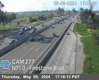


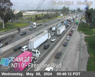
District: 7 Camera ID: 277
Location: I-710 : Firestone Blvd.
View on Google Maps
Direction: North
Elevation: 108
Location: I-710 : Firestone Blvd.
View on Google Maps
Direction: North
Elevation: 108
I-5 near Downey in Los Angeles County
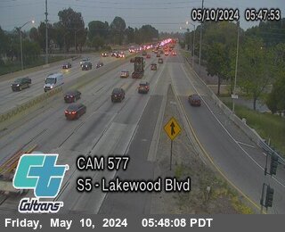


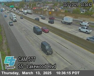
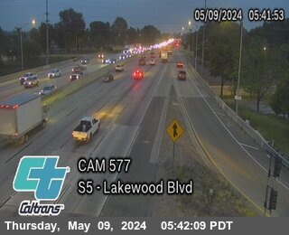
District: 7 Camera ID: 577
Location: I-5 : Lakewood Blvd
View on Google Maps
Direction: North
Elevation: 160
Location: I-5 : Lakewood Blvd
View on Google Maps
Direction: North
Elevation: 160
I-110 near Vermont Vista in Los Angeles County


District: 7 Camera ID: 1011
Location: I-110 : (171) NO Manchester Ave
View on Google Maps
Direction: South
Elevation: 90
Location: I-110 : (171) NO Manchester Ave
View on Google Maps
Direction: South
Elevation: 90
I-5 near Downey in Los Angeles County
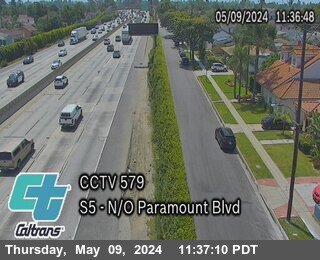


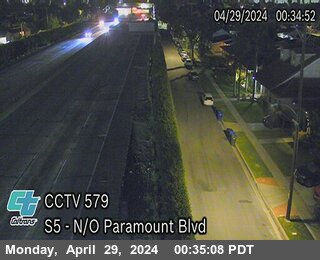
District: 7 Camera ID: 579
Location: I-5 : North of Paramount Blvd
View on Google Maps
Direction: North
Elevation: 157
Location: I-5 : North of Paramount Blvd
View on Google Maps
Direction: North
Elevation: 157
I-605 near Whittier in Los Angeles County
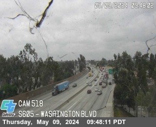


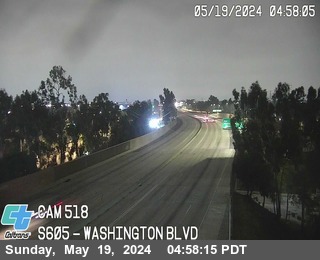
District: 7 Camera ID: 518
Location: I-605 : Washington Blvd
View on Google Maps
Direction: South
Elevation: 180
Location: I-605 : Washington Blvd
View on Google Maps
Direction: South
Elevation: 180
I-110 near South Main St in Los Angeles County
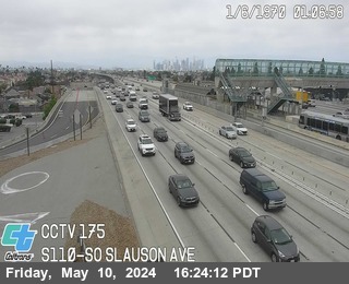


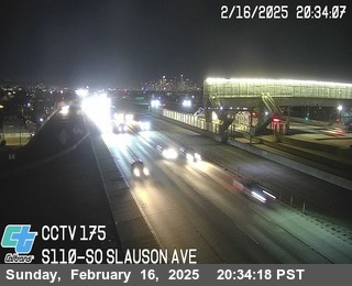
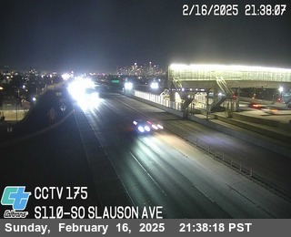
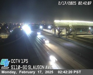
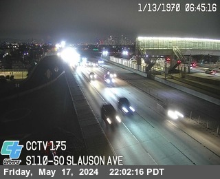
District: 7 Camera ID: 969
Location: I-110 : (175) SO SLAUSON AVE
View on Google Maps
Direction: South
Elevation: 95
Location: I-110 : (175) SO SLAUSON AVE
View on Google Maps
Direction: South
Elevation: 95
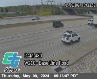
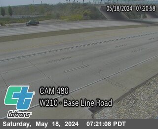
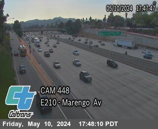
SR-60 near Rowland Heights in Los Angeles County
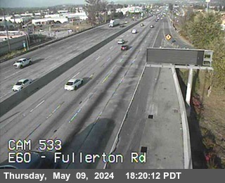


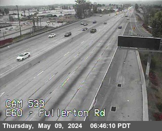
District: 7 Camera ID: 533
Location: SR-60 : Fullerton Rd
View on Google Maps
Direction: East
Elevation: 452
Location: SR-60 : Fullerton Rd
View on Google Maps
Direction: East
Elevation: 452
SR-60 near Rowland Heights in Los Angeles County
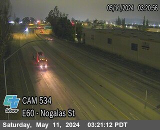


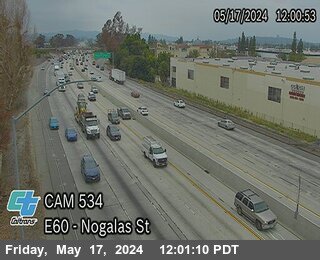
District: 7 Camera ID: 534
Location: SR-60 : East of Nogales St
View on Google Maps
Direction: East
Elevation: 475
Location: SR-60 : East of Nogales St
View on Google Maps
Direction: East
Elevation: 475
SR-60 near Hacienda Heights in Los Angeles County
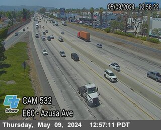


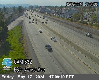
District: 7 Camera ID: 532
Location: SR-60 : Azusa Ave
View on Google Maps
Direction: East
Elevation: 416
Location: SR-60 : Azusa Ave
View on Google Maps
Direction: East
Elevation: 416
SR-60 near Walnut in Los Angeles County
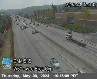


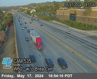
District: 7 Camera ID: 535
Location: SR-60 : West of Brea Canyon
View on Google Maps
Direction: West
Elevation: 570
Location: SR-60 : West of Brea Canyon
View on Google Maps
Direction: West
Elevation: 570
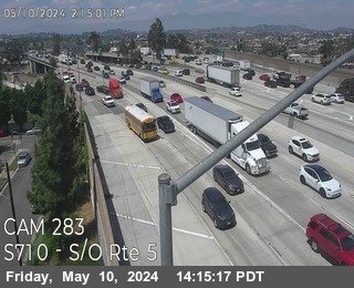
I-710 near Los Angeles in Los Angeles County
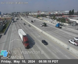


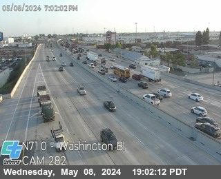
District: 7 Camera ID: 282
Location: I-710 : Washington Blvd
View on Google Maps
Direction: North
Elevation: 157
Location: I-710 : Washington Blvd
View on Google Maps
Direction: North
Elevation: 157
SR-60 near Hacienda Heights in Los Angeles County
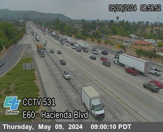


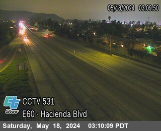
District: 7 Camera ID: 531
Location: SR-60 : Hacienda Blvd
View on Google Maps
Direction: East
Elevation: 357
Location: SR-60 : Hacienda Blvd
View on Google Maps
Direction: East
Elevation: 357
I-605 near Whittier in Los Angeles County
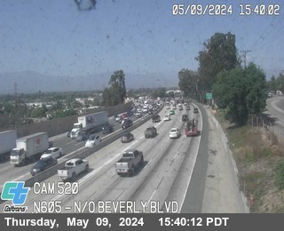


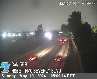
District: 7 Camera ID: 520
Location: I-605 : North of Beverly Blvd
View on Google Maps
Direction: North
Elevation: 272
Location: I-605 : North of Beverly Blvd
View on Google Maps
Direction: North
Elevation: 272
I-10 near Santa Monica in Los Angeles County


District: 7 Camera ID: 986
Location: I-10 : (102) Ocean Ave
View on Google Maps
Direction: East
Elevation: 65
Location: I-10 : (102) Ocean Ave
View on Google Maps
Direction: East
Elevation: 65
I-10 near Santa Monica in Los Angeles County
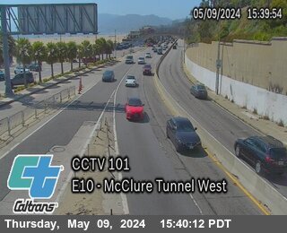


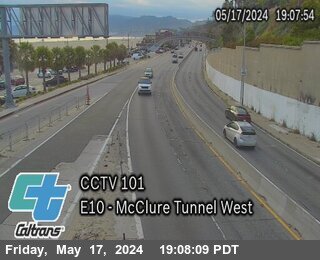
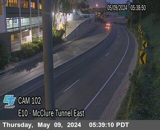
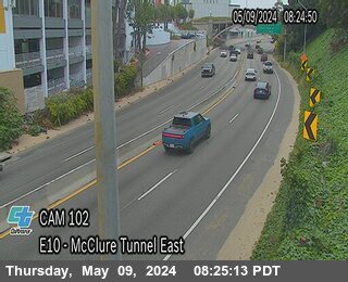
District: 7 Camera ID: 983
Location: I-10 : (101) McClure-West
View on Google Maps
Direction: East
Elevation: 95
Location: I-10 : (101) McClure-West
View on Google Maps
Direction: East
Elevation: 95
I-110 near Figueroa Street in Los Angeles County
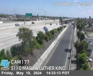


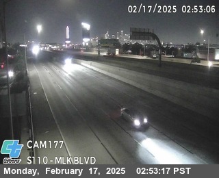
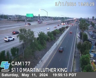
District: 7 Camera ID: 970
Location: I-110 : (177) Martin Luther King Blvd
View on Google Maps
Direction: South
Elevation: 95
Location: I-110 : (177) Martin Luther King Blvd
View on Google Maps
Direction: South
Elevation: 95
I-5 near Los Angeles in Los Angeles County


I-710 near Los Angeles in Los Angeles County


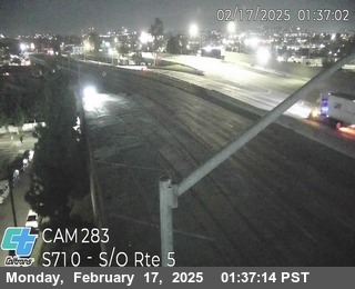

District: 7 Camera ID: 283
Location: I-710 : South of I-5
View on Google Maps
Direction: South
Elevation: 193
Location: I-710 : South of I-5
View on Google Maps
Direction: South
Elevation: 193
SR-60 near Hacienda Heights in Los Angeles County
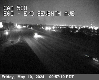


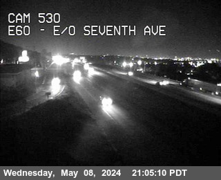
District: 7 Camera ID: 530
Location: SR-60 : East of Seventh Ave
View on Google Maps
Direction: East
Elevation: 390
Location: SR-60 : East of Seventh Ave
View on Google Maps
Direction: East
Elevation: 390
I-605 near Whittier in Los Angeles County
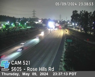


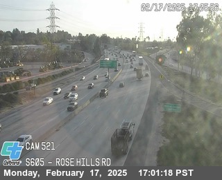
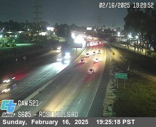
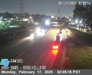
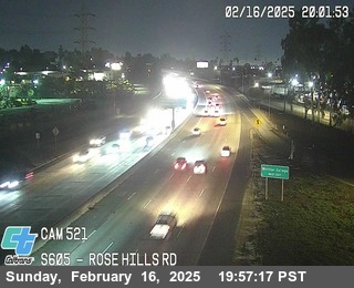
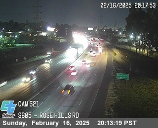
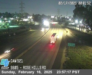
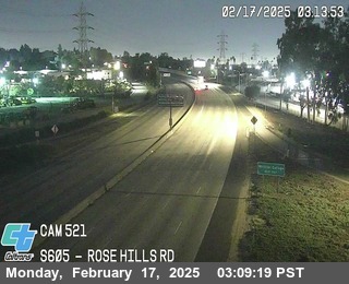

District: 7 Camera ID: 521
Location: I-605 : Rose Hills Rd
View on Google Maps
Direction: South
Elevation: 229
Location: I-605 : Rose Hills Rd
View on Google Maps
Direction: South
Elevation: 229
I-110 near University of Southern California in Los Angeles County
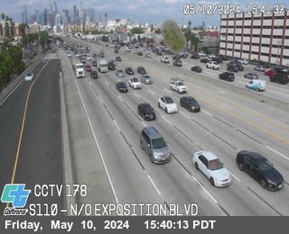


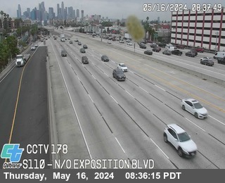
District: 7 Camera ID: 1001
Location: I-110 : (178) Exposition Blvd
View on Google Maps
Direction: South
Elevation: 95
Location: I-110 : (178) Exposition Blvd
View on Google Maps
Direction: South
Elevation: 95
SR-60 near xxx in Los Angeles County
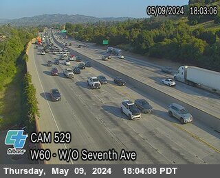


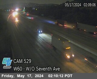
District: 7 Camera ID: 529
Location: SR-60 : West of Seventh Ave
View on Google Maps
Direction: West
Elevation: -1
Location: SR-60 : West of Seventh Ave
View on Google Maps
Direction: West
Elevation: -1
SR-60 near Diamond Bar in Los Angeles County


I-710 near Los Angeles in Los Angeles County


District: 7 Camera ID: 284
Location: I-710 : North of I-5
View on Google Maps
Direction: North
Elevation: 196
Location: I-710 : North of I-5
View on Google Maps
Direction: North
Elevation: 196
I-10 near Los Angeles in Los Angeles County
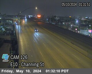


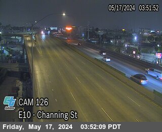
District: 7 Camera ID: 985
Location: I-10 : (126) Channing Street
View on Google Maps
Direction: East
Elevation: 213
Location: I-10 : (126) Channing Street
View on Google Maps
Direction: East
Elevation: 213
I-10 near Los Angeles in Los Angeles County


District: 7 Camera ID: 1008
Location: I-10 : (125) Griffith/San Pedro
View on Google Maps
Direction: West
Elevation: 95
Location: I-10 : (125) Griffith/San Pedro
View on Google Maps
Direction: West
Elevation: 95
I-605 near Whittier in Los Angeles County
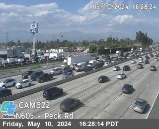


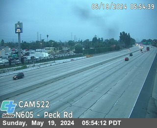
District: 7 Camera ID: 522
Location: I-605 : Peck Rd (South of I-605)
View on Google Maps
Direction: North
Elevation: 249
Location: I-605 : Peck Rd (South of I-605)
View on Google Maps
Direction: North
Elevation: 249
SR-60 near Hacienda Heights in Los Angeles County
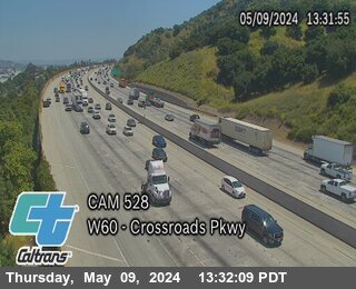


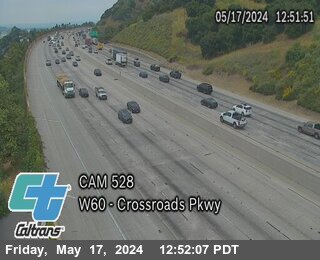
District: 7 Camera ID: 528
Location: SR-60 : Crossroads Pkwy
View on Google Maps
Direction: West
Elevation: 351
Location: SR-60 : Crossroads Pkwy
View on Google Maps
Direction: West
Elevation: 351
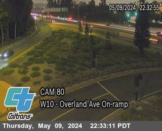
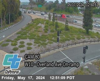
I-10 near Culver City in Los Angeles County
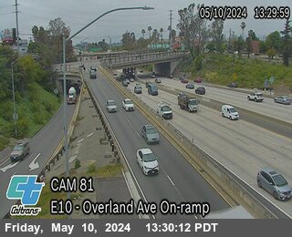


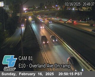
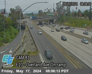
District: 7 Camera ID: 975
Location: I-10 : (81) Overland Ave On-Ramp
View on Google Maps
Direction: East
Elevation: 95
Location: I-10 : (81) Overland Ave On-Ramp
View on Google Maps
Direction: East
Elevation: 95
SR-60 near Whittier in Los Angeles County
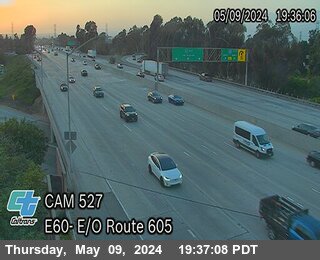


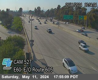
District: 7 Camera ID: 527
Location: SR-60 : Eastbound SR-60 (East of I-605)
View on Google Maps
Direction: East
Elevation: 282
Location: SR-60 : Eastbound SR-60 (East of I-605)
View on Google Maps
Direction: East
Elevation: 282
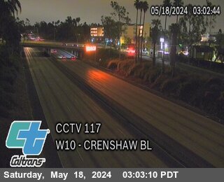
I-10 near Culver City in Los Angeles County
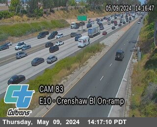


District: 7 Camera ID: 977
Location: I-10 : (83) Crenshaw Blvd On-Ramp
View on Google Maps
Direction: East
Elevation: 95
Location: I-10 : (83) Crenshaw Blvd On-Ramp
View on Google Maps
Direction: East
Elevation: 95
I-10 near Los Angeles in Los Angeles County


District: 7 Camera ID: 1007
Location: I-10 : (124) Los Angeles St
View on Google Maps
Direction: West
Elevation: 150
Location: I-10 : (124) Los Angeles St
View on Google Maps
Direction: West
Elevation: 150
I-710 near Los Angeles in Los Angeles County


I-10 near Mid City in Los Angeles County


District: 7 Camera ID: 1005
Location: I-10 : (117) Crenshaw Blvd
View on Google Maps
Direction: West
Elevation: 95
Location: I-10 : (117) Crenshaw Blvd
View on Google Maps
Direction: West
Elevation: 95
I-10 near Culver City in Los Angeles County


District: 7 Camera ID: 974
Location: I-10 : (80) Overland Ave On-Ramp
View on Google Maps
Direction: West
Elevation: 95
Location: I-10 : (80) Overland Ave On-Ramp
View on Google Maps
Direction: West
Elevation: 95
I-10 near Culver City in Los Angeles County


District: 7 Camera ID: 976
Location: I-10 : (82) Crenshaw Blvd On-Ramp
View on Google Maps
Direction: West
Elevation: 95
Location: I-10 : (82) Crenshaw Blvd On-Ramp
View on Google Maps
Direction: West
Elevation: 95
I-10 near Culver City in Los Angeles County
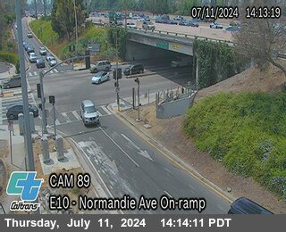


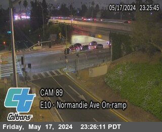
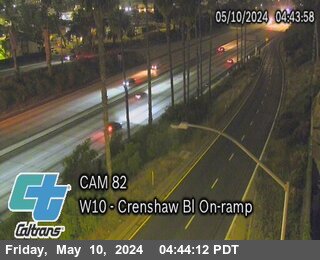
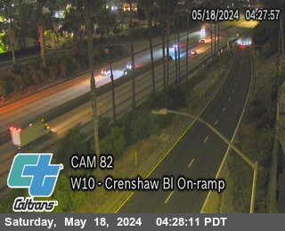
District: 7 Camera ID: 987
Location: I-10 : (89) Normandie Ave On-Ramp
View on Google Maps
Direction: East
Elevation: 95
Location: I-10 : (89) Normandie Ave On-Ramp
View on Google Maps
Direction: East
Elevation: 95
I-10 near Culver City in Los Angeles County
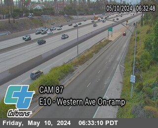


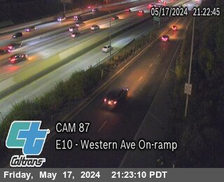
District: 7 Camera ID: 979
Location: I-10 : (87) Western Ave On-Ramp
View on Google Maps
Direction: East
Elevation: 95
Location: I-10 : (87) Western Ave On-Ramp
View on Google Maps
Direction: East
Elevation: 95
I-10 near Culver city in Los Angeles County


District: 7 Camera ID: 973
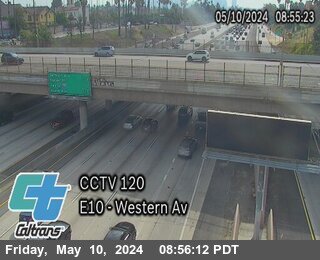
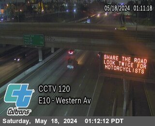
Location: I-10 : (120) Western Avenue
View on Google Maps
Direction: East
Elevation: 213
Location: I-10 : (120) Western Avenue
View on Google Maps
Direction: East
Elevation: 213
I-10 near Culver City in Los Angeles County


District: 7 Camera ID: 982
Location: I-10 : (92) Hoover St On-Ramp
View on Google Maps
Direction: West
Elevation: 95
Location: I-10 : (92) Hoover St On-Ramp
View on Google Maps
Direction: West
Elevation: 95
I-10 near University Park in Los Angeles County


District: 7 Camera ID: 1006
Location: I-10 : RT 110 (CHP Tower)
View on Google Maps
Direction: East
Elevation: 95
Location: I-10 : RT 110 (CHP Tower)
View on Google Maps
Direction: East
Elevation: 95
I-10 near Culver City in Los Angeles County


District: 7 Camera ID: 978
Location: I-10 : (86) Western Ave On-Ramp
View on Google Maps
Direction: West
Elevation: 95
Location: I-10 : (86) Western Ave On-Ramp
View on Google Maps
Direction: West
Elevation: 95
I-605 near Whittier in Los Angeles County
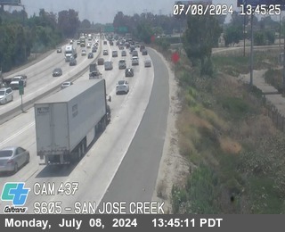


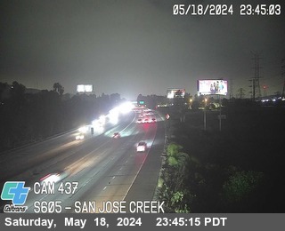
District: 7 Camera ID: 437
Location: I-605 : San Jose Creek
View on Google Maps
Direction: South
Elevation: 265
Location: I-605 : San Jose Creek
View on Google Maps
Direction: South
Elevation: 265
SR-57 near Pomona in Los Angeles County
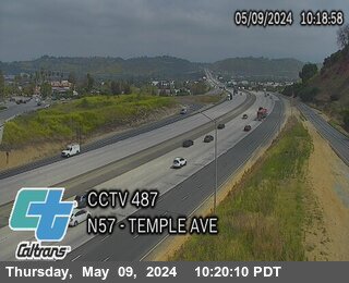


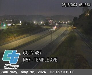
District: 7 Camera ID: 487
Location: SR-57 : Temple Ave
View on Google Maps
Direction: North
Elevation: 879
Location: SR-57 : Temple Ave
View on Google Maps
Direction: North
Elevation: 879
I-110 near LA Live in Los Angeles County


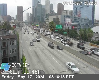
District: 7 Camera ID: 1015
Location: I-110 : (184) 11th St
View on Google Maps
Direction: South
Elevation: 95
Location: I-110 : (184) 11th St
View on Google Maps
Direction: South
Elevation: 95
I-110 near Financial District in Los Angeles County
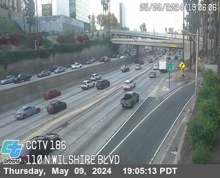


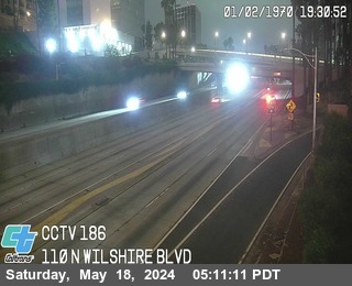
District: 7 Camera ID: 1002
Location: I-110 : (186) Wilshire Blvd
View on Google Maps
Direction: North
Elevation: 95
Location: I-110 : (186) Wilshire Blvd
View on Google Maps
Direction: North
Elevation: 95
I-605 near La Puente in Los Angeles County
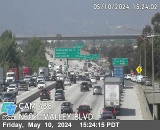


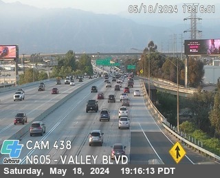
District: 7 Camera ID: 438
Location: I-605 : Valley Blvd
View on Google Maps
Direction: North
Elevation: 308
Location: I-605 : Valley Blvd
View on Google Maps
Direction: North
Elevation: 308
I-5 near Los Angeles in Los Angeles County
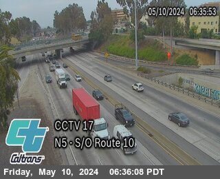


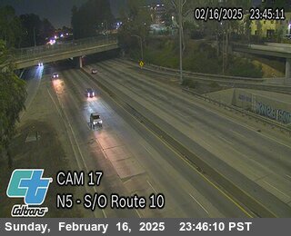
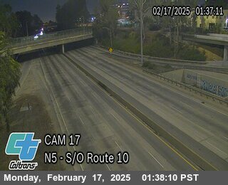
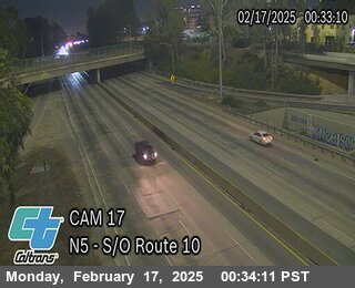
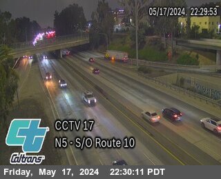
District: 7 Camera ID: 17
Location: I-5 : South of I-10
View on Google Maps
Direction: North
Elevation: 341
Location: I-5 : South of I-10
View on Google Maps
Direction: North
Elevation: 341
I-710 near Monterey Park in Los Angeles County
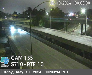


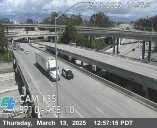
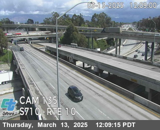
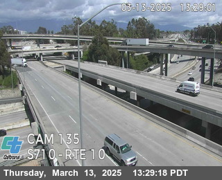
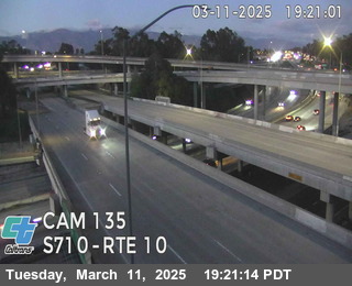
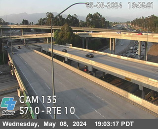
District: 7 Camera ID: 135
Location: I-710 : South of I-10
View on Google Maps
Direction: South
Elevation: 357
Location: I-710 : South of I-10
View on Google Maps
Direction: South
Elevation: 357
SR-57 near Pomona in Los Angeles County


I-10 near El Monte in Los Angeles County
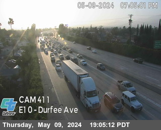


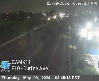
District: 7 Camera ID: 411
Location: I-10 : Durfee Ave
View on Google Maps
Direction: East
Elevation: 295
Location: I-10 : Durfee Ave
View on Google Maps
Direction: East
Elevation: 295
I-10 near Baldwin Park in Los Angeles County

District: 7 Camera ID: 412
Location: I-10 : West of I-605
View on Google Maps
Direction: East
Elevation: 308
Location: I-10 : West of I-605
View on Google Maps
Direction: East
Elevation: 308
I-10 near Baldwin Park in Los Angeles County


District: 7 Camera ID: 413
Location: I-10 : West I-10 / I-605
View on Google Maps
Direction: West
Elevation: 314
Location: I-10 : West I-10 / I-605
View on Google Maps
Direction: West
Elevation: 314
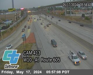
I-605 near Baldwin Park in Los Angeles County
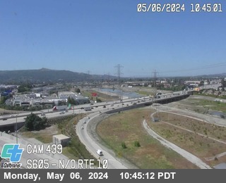
District: 7 Camera ID: 439
Location: I-605 : North of I-10
View on Google Maps
Direction: North
Elevation: 318
Location: I-605 : North of I-10
View on Google Maps
Direction: North
Elevation: 318
I-10 near Covina in Los Angeles County
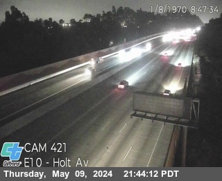


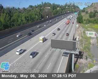
District: 7 Camera ID: 421
Location: I-10 : East of Holt Ave
View on Google Maps
Direction: East
Elevation: 685
Location: I-10 : East of Holt Ave
View on Google Maps
Direction: East
Elevation: 685
I-10 near Baldwin Park in Los Angeles County
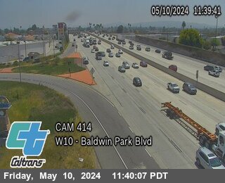


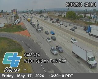
District: 7 Camera ID: 414
Location: I-10 : Baldwin Park Bl
View on Google Maps
Direction: West
Elevation: 344
Location: I-10 : Baldwin Park Bl
View on Google Maps
Direction: West
Elevation: 344
I-10 near Alhambra in Los Angeles County
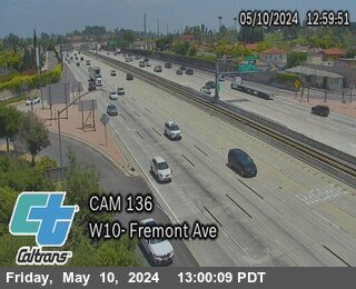


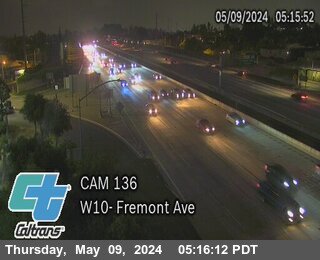
District: 7 Camera ID: 136
Location: I-10 : Fremont Ave
View on Google Maps
Direction: West
Elevation: 433
Location: I-10 : Fremont Ave
View on Google Maps
Direction: West
Elevation: 433
I-10 near Covina in Los Angeles County
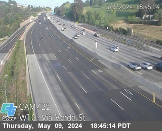


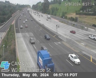
District: 7 Camera ID: 422
Location: I-10 : Via Verde St
View on Google Maps
Direction: West
Elevation: 921
Location: I-10 : Via Verde St
View on Google Maps
Direction: West
Elevation: 921
I-10 near Pomona in Los Angeles County
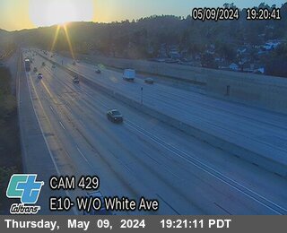


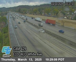
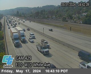
District: 7 Camera ID: 429
Location: I-10 : West of White Ave
View on Google Maps
Direction: East
Elevation: 879
Location: I-10 : West of White Ave
View on Google Maps
Direction: East
Elevation: 879
I-10 near Baldwin Park in Los Angeles County
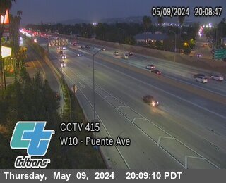


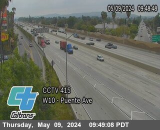
District: 7 Camera ID: 415
Location: I-10 : Puente Ave
View on Google Maps
Direction: West
Elevation: 357
Location: I-10 : Puente Ave
View on Google Maps
Direction: West
Elevation: 357
I-10 near Alhambra in Los Angeles County


District: 7 Camera ID: 403
Location: I-10 : Garfield Ave
View on Google Maps
Direction: East
Elevation: 419
Location: I-10 : Garfield Ave
View on Google Maps
Direction: East
Elevation: 419
I-10 near West Covina in Los Angeles County
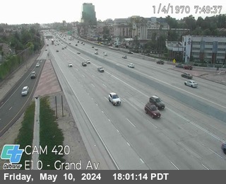


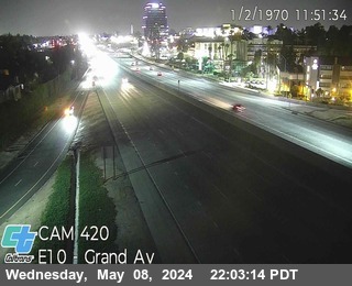
District: 7 Camera ID: 420
Location: I-10 : Grand Ave
View on Google Maps
Direction: East
Elevation: 528
Location: I-10 : Grand Ave
View on Google Maps
Direction: East
Elevation: 528
I-10 near West Covina in Los Angeles County
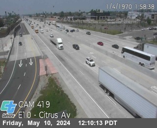


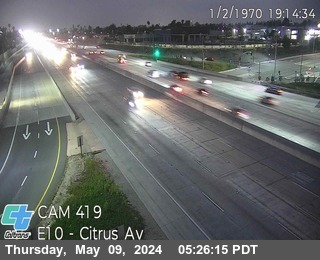
District: 7 Camera ID: 419
Location: I-10 : Citrus St
View on Google Maps
Direction: East
Elevation: 488
Location: I-10 : Citrus St
View on Google Maps
Direction: East
Elevation: 488
I-10 near Rosemead in Los Angeles County


District: 7 Camera ID: 406
Location: I-10 : San Gabriel Blvd
View on Google Maps
Direction: East
Elevation: 314
Location: I-10 : San Gabriel Blvd
View on Google Maps
Direction: East
Elevation: 314
I-10 near Alhambra in Los Angeles County
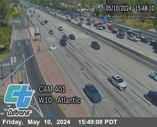


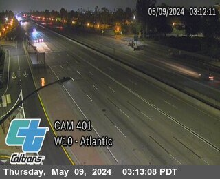
District: 7 Camera ID: 401
Location: I-10 : West of Atlantic Blvd
View on Google Maps
Direction: West
Elevation: 426
Location: I-10 : West of Atlantic Blvd
View on Google Maps
Direction: West
Elevation: 426
I-10 near West Covina in Los Angeles County
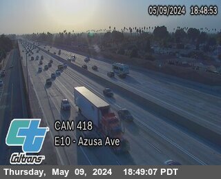


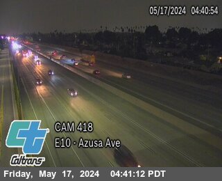
District: 7 Camera ID: 418
Location: I-10 : Azusa Ave
View on Google Maps
Direction: East
Elevation: 442
Location: I-10 : Azusa Ave
View on Google Maps
Direction: East
Elevation: 442
I-10 near Pomona in Los Angeles County
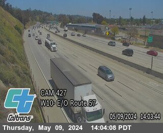


District: 7 Camera ID: 427
Location: I-10 : East of SR-57
View on Google Maps
Direction: West
Elevation: 823
Location: I-10 : East of SR-57
View on Google Maps
Direction: West
Elevation: 823
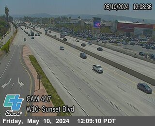
I-10 near San Gabriel in Los Angeles County


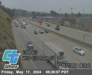
I-10 near West Covina in Los Angeles County
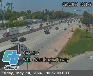


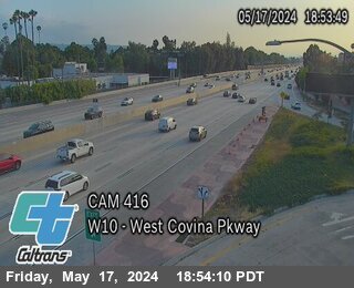
District: 7 Camera ID: 416
Location: I-10 : West Covina Parkway
View on Google Maps
Direction: West
Elevation: 387
Location: I-10 : West Covina Parkway
View on Google Maps
Direction: West
Elevation: 387
I-10 near West Covina in Los Angeles County


District: 7 Camera ID: 417
Location: I-10 : Sunset Ave
View on Google Maps
Direction: West
Elevation: 390
Location: I-10 : Sunset Ave
View on Google Maps
Direction: West
Elevation: 390
I-110 near Elysian Park in Los Angeles County


District: 7 Camera ID: 999
Location: I-110 : (191) Hill Street Exit
View on Google Maps
Direction: North
Elevation: 95
Location: I-110 : (191) Hill Street Exit
View on Google Maps
Direction: North
Elevation: 95
I-10 near Pomona in Los Angeles County


District: 7 Camera ID: 428
Location: I-10 : Dudley St
View on Google Maps
Direction: West
Elevation: 856
Location: I-10 : Dudley St
View on Google Maps
Direction: West
Elevation: 856
US-101 near Los Angeles in Los Angeles County
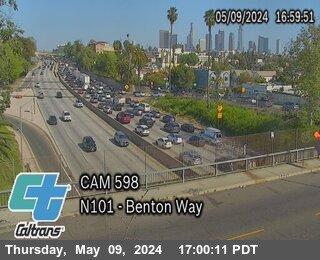


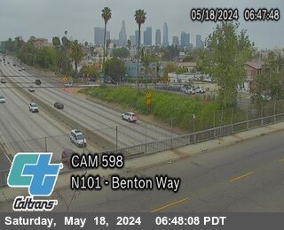
District: 7 Camera ID: 598
Location: US-101 : Benton Way
View on Google Maps
Direction: North
Elevation: 387
Location: US-101 : Benton Way
View on Google Maps
Direction: North
Elevation: 387
I-110 near Elysian Park in Los Angeles County
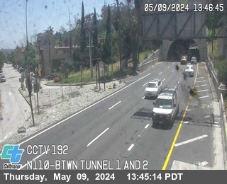


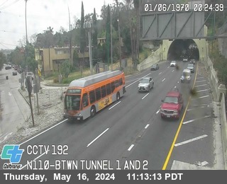
District: 7 Camera ID: 1000
Location: I-110 : (192) Between Tunnel 1 and 2
View on Google Maps
Direction: North
Elevation: 95
Location: I-110 : (192) Between Tunnel 1 and 2
View on Google Maps
Direction: North
Elevation: 95
I-110 near Elysian Park in Los Angeles County
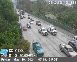


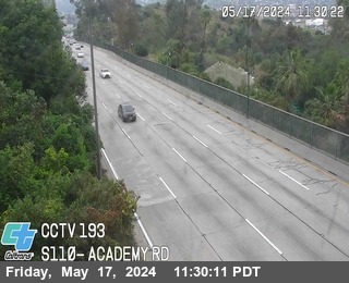
District: 7 Camera ID: 971
Location: I-110 : (193) Academy Road
View on Google Maps
Direction: South
Elevation: 95
Location: I-110 : (193) Academy Road
View on Google Maps
Direction: South
Elevation: 95
I-10 near Pomona in Los Angeles County
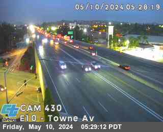


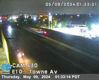
District: 7 Camera ID: 430
Location: I-10 : Towne Ave
View on Google Maps
Direction: East
Elevation: 987
Location: I-10 : Towne Ave
View on Google Maps
Direction: East
Elevation: 987
SR-57 near San Dimas in Los Angeles County
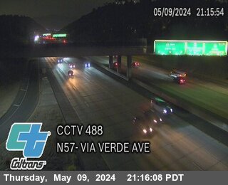


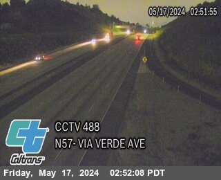
District: 7 Camera ID: 488
Location: SR-57 : Via Verde Ave
View on Google Maps
Direction: North
Elevation: 1069
Location: SR-57 : Via Verde Ave
View on Google Maps
Direction: North
Elevation: 1069
I-110 near Elysian Park in Los Angeles County
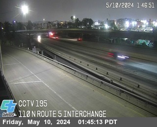


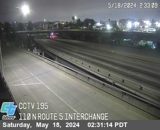
District: 7 Camera ID: 1012
Location: I-110 : (195) Route 5 Interchange
View on Google Maps
Direction: North
Elevation: 95
Location: I-110 : (195) Route 5 Interchange
View on Google Maps
Direction: North
Elevation: 95
I-10 near Claremont in Los Angeles County
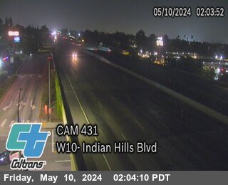
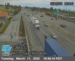
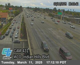
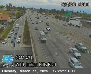
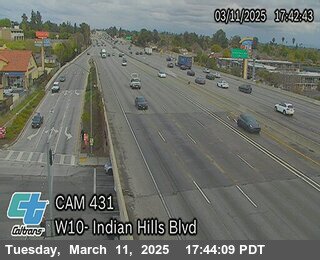
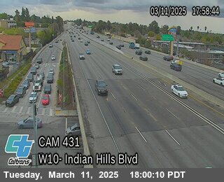
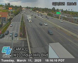
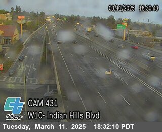
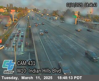
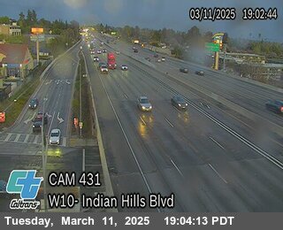
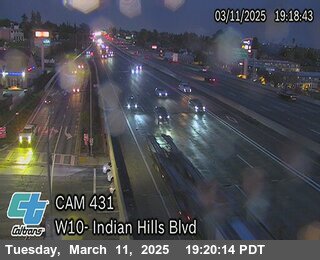
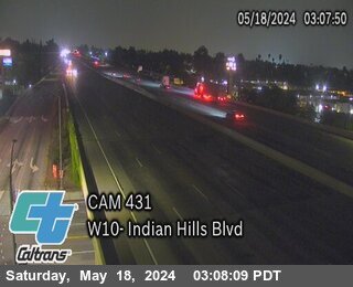
District: 7 Camera ID: 431
Location: I-10 : Indian Hill Blvd
View on Google Maps
Direction: West
Elevation: 1036
Location: I-10 : Indian Hill Blvd
View on Google Maps
Direction: West
Elevation: 1036
US-101 near Los Angeles in Los Angeles County


District: 7 Camera ID: 602
Location: US-101 : South of Melrose Ave
View on Google Maps
Direction: South
Elevation: 318
Location: US-101 : South of Melrose Ave
View on Google Maps
Direction: South
Elevation: 318
I-110 near Cypress Park in Alameda County
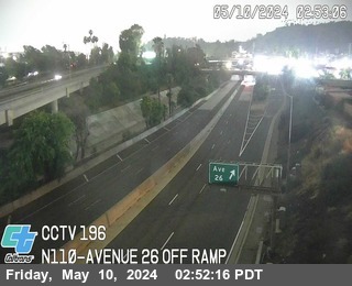


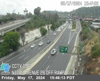
District: 7 Camera ID: 1
Location: I-110 : (196) Avenue 26 Off Ramp
View on Google Maps
Direction: South
Elevation: 95
Location: I-110 : (196) Avenue 26 Off Ramp
View on Google Maps
Direction: South
Elevation: 95
US-101 near Los Angeles in Los Angeles County
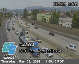


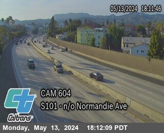
District: 7 Camera ID: 604
Location: US-101 : North of Normandie Ave
View on Google Maps
Direction: South
Elevation: 321
Location: US-101 : North of Normandie Ave
View on Google Maps
Direction: South
Elevation: 321
I-5 near Elysian Park in Los Angeles County
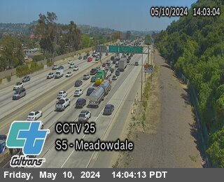


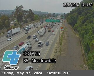
District: 7 Camera ID: 25
Location: I-5 : Meadowdale
View on Google Maps
Direction: South
Elevation: 400
Location: I-5 : Meadowdale
View on Google Maps
Direction: South
Elevation: 400
US-101 near Los Angeles in Los Angeles County
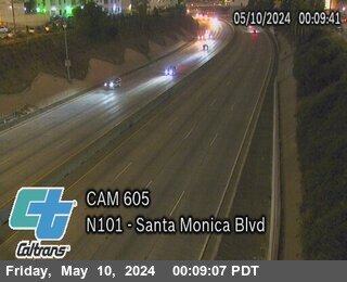


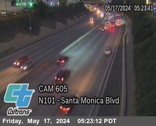
District: 7 Camera ID: 605
Location: US-101 : Santa Monica
View on Google Maps
Direction: North
Elevation: 324
Location: US-101 : Santa Monica
View on Google Maps
Direction: North
Elevation: 324
I-605 near Baldwin Park in Los Angeles County
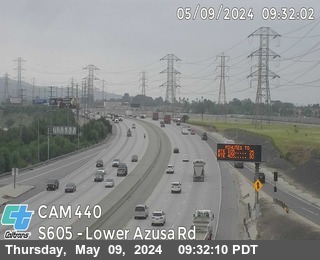


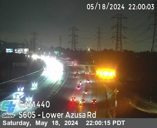
District: 7 Camera ID: 440
Location: I-605 : Lower Azusa Rd
View on Google Maps
Direction: South
Elevation: 344
Location: I-605 : Lower Azusa Rd
View on Google Maps
Direction: South
Elevation: 344
US-101 near xxx in Los Angeles County
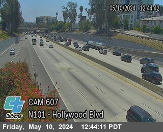


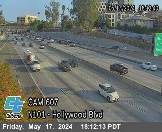
District: 7 Camera ID: 607
Location: US-101 : Hollywood Blvd
View on Google Maps
Direction: North
Elevation: -1
Location: US-101 : Hollywood Blvd
View on Google Maps
Direction: North
Elevation: -1
SR-57 near San Dimas in Los Angeles County
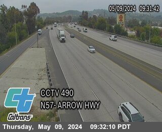


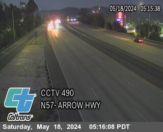
District: 7 Camera ID: 490
Location: SR-57 : Arrow Hwy
View on Google Maps
Direction: North
Elevation: 908
Location: SR-57 : Arrow Hwy
View on Google Maps
Direction: North
Elevation: 908
I-405 near Los Angeles in Los Angeles County


District: 7 Camera ID: 671
Location: I-405 : Bel Air Crest Drive
View on Google Maps
Direction: North
Elevation: 974
Location: I-405 : Bel Air Crest Drive
View on Google Maps
Direction: North
Elevation: 974
SR-2 near LA River in Los Angeles County
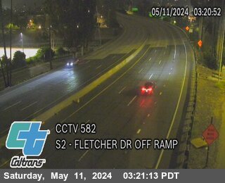


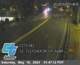
District: 7 Camera ID: 972
Location: SR-2 (582) : Fletcher Drive Off Ramp
View on Google Maps
Direction: West
Elevation: 150
Location: SR-2 (582) : Fletcher Drive Off Ramp
View on Google Maps
Direction: West
Elevation: 150
US-101 near Los Angeles in Los Angeles County
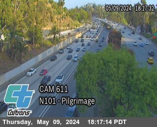


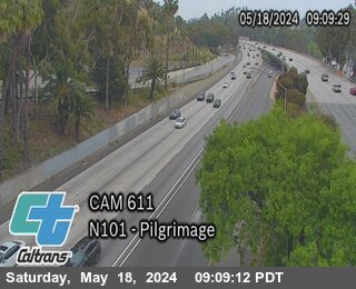
District: 7 Camera ID: 611
Location: US-101 : Pilgrimage
View on Google Maps
Direction: North
Elevation: 554
Location: US-101 : Pilgrimage
View on Google Maps
Direction: North
Elevation: 554
I-605 near Duarte in Los Angeles County
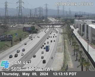


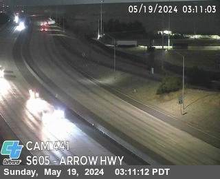
District: 7 Camera ID: 441
Location: I-605 : Arrow Hwy
View on Google Maps
Direction: South
Elevation: 419
Location: I-605 : Arrow Hwy
View on Google Maps
Direction: South
Elevation: 419
SR-57 near San Dimas in Los Angeles County
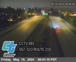


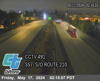
District: 7 Camera ID: 491
Location: SR-57 : South of I-210
View on Google Maps
Direction: South
Elevation: 915
Location: SR-57 : South of I-210
View on Google Maps
Direction: South
Elevation: 915
SR-2 near Los Angeles in Los Angeles County
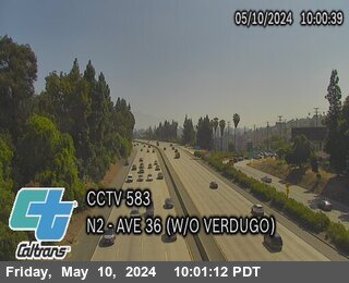


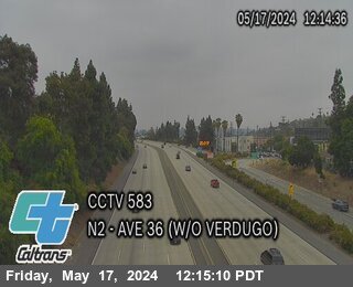
District: 7 Camera ID: 583
Location: SR-2 : Ave 36 (West of Verdugo)
View on Google Maps
Direction: East
Elevation: 442
Location: SR-2 : Ave 36 (West of Verdugo)
View on Google Maps
Direction: East
Elevation: 442
I-210 near La Verne in Los Angeles County
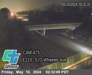


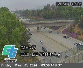
District: 7 Camera ID: 475
Location: I-210 : East of Wheeler Ave
View on Google Maps
Direction: East
Elevation: 1145
Location: I-210 : East of Wheeler Ave
View on Google Maps
Direction: East
Elevation: 1145
I-210 near La Verne in Los Angeles County


I-210 near Claremont in Los Angeles County
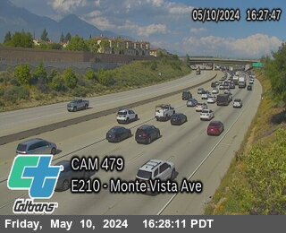


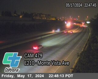
District: 7 Camera ID: 479
Location: I-210 : West of Monte Vista Ave
View on Google Maps
Direction: East
Elevation: 1492
Location: I-210 : West of Monte Vista Ave
View on Google Maps
Direction: East
Elevation: 1492
I-210 near Claremont in Los Angeles County
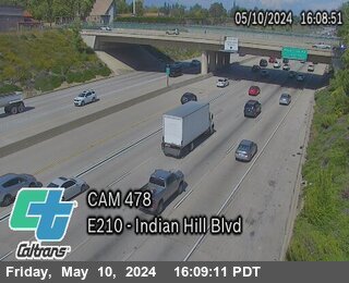


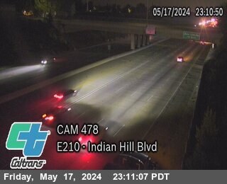
District: 7 Camera ID: 478
Location: I-210 : Indian Hill Blvd
View on Google Maps
Direction: East
Elevation: 1377
Location: I-210 : Indian Hill Blvd
View on Google Maps
Direction: East
Elevation: 1377
I-210 near Claremont in Los Angeles County
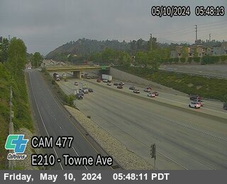


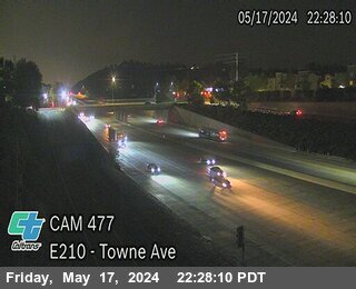
District: 7 Camera ID: 477
Location: I-210 : Town Ave
View on Google Maps
Direction: East
Elevation: 1315
Location: I-210 : Town Ave
View on Google Maps
Direction: East
Elevation: 1315
I-210 near San Dimas in Los Angeles County
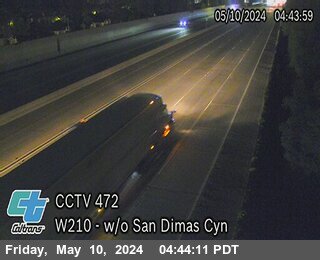


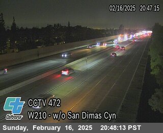
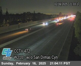
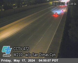
District: 7 Camera ID: 472
Location: I-210 : West of Sandimas Cyn
View on Google Maps
Direction: West
Elevation: 1049
Location: I-210 : West of Sandimas Cyn
View on Google Maps
Direction: West
Elevation: 1049
I-210 near Azusa in Los Angeles County


District: 7 Camera ID: 783
Location: I-210 : Azusa Ave
View on Google Maps
Direction: East
Elevation: 541
Location: I-210 : Azusa Ave
View on Google Maps
Direction: East
Elevation: 541
I-210 near Azusa in Los Angeles County
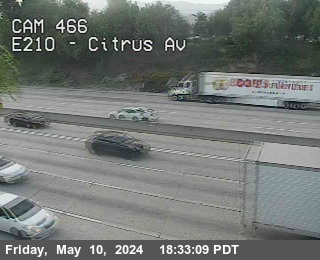


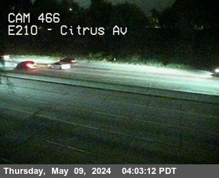
District: 7 Camera ID: 466
Location: I-210 : Citrus Ave Off-Ramp
View on Google Maps
Direction: East
Elevation: 583
Location: I-210 : Citrus Ave Off-Ramp
View on Google Maps
Direction: East
Elevation: 583
I-210 near Glendora in Los Angeles County
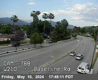


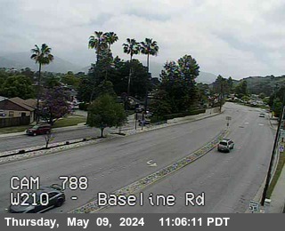
District: 7 Camera ID: 788
Location: I-210 : Baseline Rd
View on Google Maps
Direction: West
Elevation: 692
Location: I-210 : Baseline Rd
View on Google Maps
Direction: West
Elevation: 692
I-210 near Azusa in Los Angeles County


District: 7 Camera ID: 786
Location: I-210 : Citrus Ave-Baseline
View on Google Maps
Direction: West
Elevation: 613
Location: I-210 : Citrus Ave-Baseline
View on Google Maps
Direction: West
Elevation: 613
I-210 near Claremont in Los Angeles County


District: 7 Camera ID: 480
Location: I-210 : Base Line Road
View on Google Maps
Direction: West
Elevation: 1551
Location: I-210 : Base Line Road
View on Google Maps
Direction: West
Elevation: 1551
I-210 near xxx in Los Angeles County
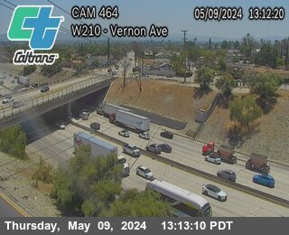


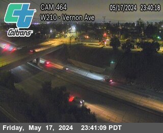
District: 7 Camera ID: 464
Location: I-210 : Vernon Ave On-Ramp
View on Google Maps
Direction: West
Elevation: -1
Location: I-210 : Vernon Ave On-Ramp
View on Google Maps
Direction: West
Elevation: -1
I-210 near Duarte in Los Angeles County
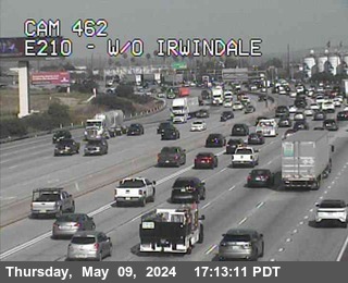


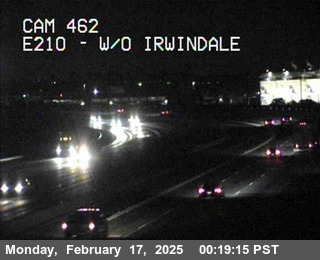
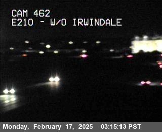
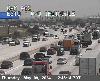
District: 7 Camera ID: 462
Location: I-210 : West of Irwindale
View on Google Maps
Direction: East
Elevation: 544
Location: I-210 : West of Irwindale
View on Google Maps
Direction: East
Elevation: 544
I-605 near Duarte in Los Angeles County
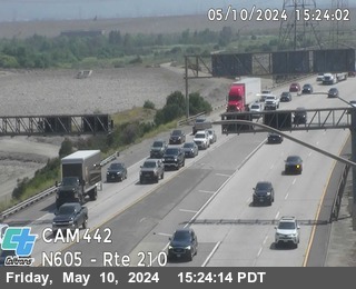


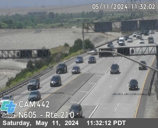
District: 7 Camera ID: 442
Location: I-605 : South of I-210
View on Google Maps
Direction: North
Elevation: 538
Location: I-605 : South of I-210
View on Google Maps
Direction: North
Elevation: 538
US-101 near Universal City in Los Angeles County


District: 7 Camera ID: 615
Location: US-101 : University Center Dr
View on Google Maps
Direction: South
Elevation: 734
Location: US-101 : University Center Dr
View on Google Maps
Direction: South
Elevation: 734
I-210 near Duarte in Los Angeles County
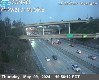


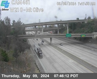
District: 7 Camera ID: 461
Location: I-210 : Mt Olive
View on Google Maps
Direction: West
Elevation: 534
Location: I-210 : Mt Olive
View on Google Maps
Direction: West
Elevation: 534
I-210 near Monrovia in Los Angeles County


District: 7 Camera ID: 778
Location: I-210 : California-Evergreen
View on Google Maps
Direction: East
Elevation: 482
Location: I-210 : California-Evergreen
View on Google Maps
Direction: East
Elevation: 482
I-210 near Monrovia in Los Angeles County
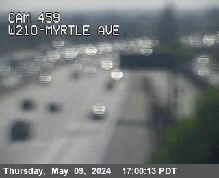


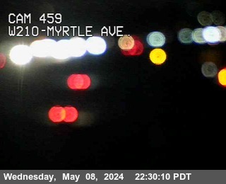
District: 7 Camera ID: 459
Location: I-210 : Myrtle Ave
View on Google Maps
Direction: West
Elevation: 462
Location: I-210 : Myrtle Ave
View on Google Maps
Direction: West
Elevation: 462
I-210 near Monrovia in Los Angeles County


District: 7 Camera ID: 775
Location: I-210 : Myrtle-Central
View on Google Maps
Direction: West
Elevation: 462
Location: I-210 : Myrtle-Central
View on Google Maps
Direction: West
Elevation: 462
I-210 near Monrovia in Los Angeles County


District: 7 Camera ID: 777
Location: I-210 : California-Central
View on Google Maps
Direction: West
Elevation: 488
Location: I-210 : California-Central
View on Google Maps
Direction: West
Elevation: 488
I-210 near Monrovia in Los Angeles County


District: 7 Camera ID: 779
Location: I-210 : Mountain-Central
View on Google Maps
Direction: West
Elevation: 498
Location: I-210 : Mountain-Central
View on Google Maps
Direction: West
Elevation: 498
I-210 near Monrovia in Los Angeles County
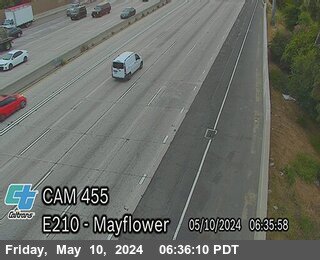


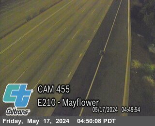
District: 7 Camera ID: 455
Location: I-210 : Mayflower Ave
View on Google Maps
Direction: East
Elevation: 452
Location: I-210 : Mayflower Ave
View on Google Maps
Direction: East
Elevation: 452
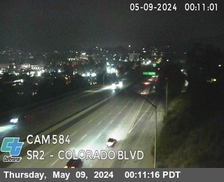
SR-2 near Glendale in Los Angeles County


US-101 near Studio City in Los Angeles County
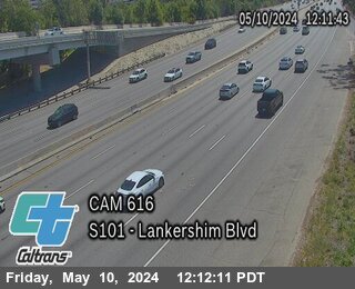


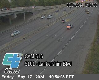
District: 7 Camera ID: 616
Location: US-101 : Lankershim Blvd
View on Google Maps
Direction: South
Elevation: 583
Location: US-101 : Lankershim Blvd
View on Google Maps
Direction: South
Elevation: 583
I-210 near Monrovia in Los Angeles County


District: 7 Camera ID: 773
Location: I-210 : Huntington Ave
View on Google Maps
Direction: West
Elevation: 485
Location: I-210 : Huntington Ave
View on Google Maps
Direction: West
Elevation: 485
I-210 near Monrovia in Los Angeles County
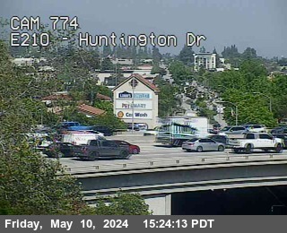


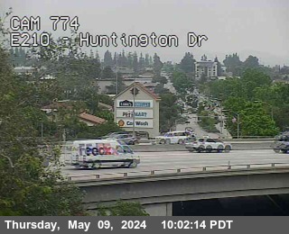
District: 7 Camera ID: 774
Location: I-210 : Huntington Ave
View on Google Maps
Direction: East
Elevation: 472
Location: I-210 : Huntington Ave
View on Google Maps
Direction: East
Elevation: 472
I-210 near Monrovia in Los Angeles County


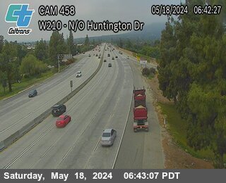
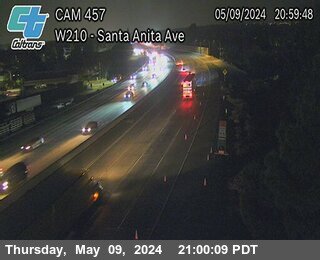
District: 7 Camera ID: 458
Location: I-210 : North of Huntington Dr
View on Google Maps
Direction: West
Elevation: 498
Location: I-210 : North of Huntington Dr
View on Google Maps
Direction: West
Elevation: 498
US-101 near Agoura Hills in Los Angeles County
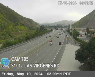


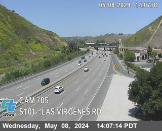
District: 7 Camera ID: 705
Location: US-101 : Las Virgenes Road
View on Google Maps
Direction: South
Elevation: 774
Location: US-101 : Las Virgenes Road
View on Google Maps
Direction: South
Elevation: 774
I-210 near Arcadia in Los Angeles County


District: 7 Camera ID: 457
Location: I-210 : Santa Anita Ave
View on Google Maps
Direction: West
Elevation: 547
Location: I-210 : Santa Anita Ave
View on Google Maps
Direction: West
Elevation: 547
I-210 near Pasadena in Los Angeles County


District: 7 Camera ID: 767
Location: I-210 : East Colorado
View on Google Maps
Direction: East
Elevation: 672
Location: I-210 : East Colorado
View on Google Maps
Direction: East
Elevation: 672
I-210 near Arcadia in Los Angeles County


District: 7 Camera ID: 770
Location: I-210 : Baldwin Ave
View on Google Maps
Direction: East
Elevation: 597
Location: I-210 : Baldwin Ave
View on Google Maps
Direction: East
Elevation: 597
I-210 near Arcadia in Los Angeles County


District: 7 Camera ID: 771
Location: I-210 : Santa Anita Ave
View on Google Maps
Direction: West
Elevation: 538
Location: I-210 : Santa Anita Ave
View on Google Maps
Direction: West
Elevation: 538
I-210 near Arcadia in Los Angeles County
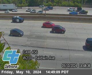


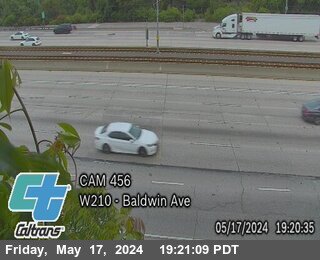
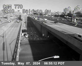
District: 7 Camera ID: 456
Location: I-210 : Baldwin Ave
View on Google Maps
Direction: West
Elevation: 626
Location: I-210 : Baldwin Ave
View on Google Maps
Direction: West
Elevation: 626
I-5 near Los Angeles in Los Angeles County


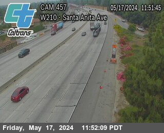
I-210 near Pasadena in Los Angeles County


I-210 near Pasadena in Los Angeles County


District: 7 Camera ID: 449
Location: I-210 : Lake Ave
View on Google Maps
Direction: East
Elevation: 843
Location: I-210 : Lake Ave
View on Google Maps
Direction: East
Elevation: 843
I-210 near Pasadena in Los Angeles County


District: 7 Camera ID: 761
Location: I-210 : Altadena-Corson
View on Google Maps
Direction: East
Elevation: 807
Location: I-210 : Altadena-Corson
View on Google Maps
Direction: East
Elevation: 807
I-210 near Pasadena in Los Angeles County
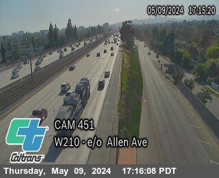


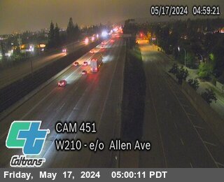
District: 7 Camera ID: 451
Location: I-210 : East of Allen Ave
View on Google Maps
Direction: West
Elevation: 846
Location: I-210 : East of Allen Ave
View on Google Maps
Direction: West
Elevation: 846
I-210 near Pasadena in Los Angeles County


District: 7 Camera ID: 450
Location: I-210 : Allen Ave On-Ramp
View on Google Maps
Direction: East
Elevation: 846
Location: I-210 : Allen Ave On-Ramp
View on Google Maps
Direction: East
Elevation: 846
I-210 near Pasadena in Los Angeles County


District: 7 Camera ID: 756
Location: I-210 : Hill-Maple
View on Google Maps
Direction: West
Elevation: 843
Location: I-210 : Hill-Maple
View on Google Maps
Direction: West
Elevation: 843
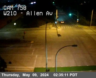
I-210 near Pasadena in Los Angeles County


District: 7 Camera ID: 452
Location: I-210 : West of Altadena Dr
View on Google Maps
Direction: West
Elevation: 816
Location: I-210 : West of Altadena Dr
View on Google Maps
Direction: West
Elevation: 816
I-210 near Pasadena in Los Angeles County


District: 7 Camera ID: 758
Location: I-210 : Allen-Maple
View on Google Maps
Direction: West
Elevation: 833
Location: I-210 : Allen-Maple
View on Google Maps
Direction: West
Elevation: 833
I-210 near Pasadena in Los Angeles County


District: 7 Camera ID: 762
Location: I-210 : W Maple-Sierra Madre
View on Google Maps
Direction: West
Elevation: 777
Location: I-210 : W Maple-Sierra Madre
View on Google Maps
Direction: West
Elevation: 777
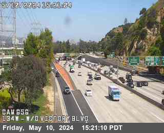
SR-134 near Burbank in Los Angeles County


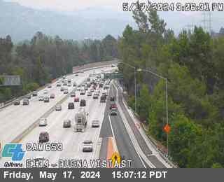
District: 7 Camera ID: 963
Location: SR-134 : (653) Buena Vista
View on Google Maps
Direction: East
Elevation: 95
Location: SR-134 : (653) Buena Vista
View on Google Maps
Direction: East
Elevation: 95
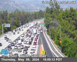
I-5 near Los Angeles Zoo in Los Angeles County


District: 7 Camera ID: 984
Location: I-5 : (33) SB Route 5 at Route 134
View on Google Maps
Direction: South
Elevation: 200
Location: I-5 : (33) SB Route 5 at Route 134
View on Google Maps
Direction: South
Elevation: 200
SR-134 near Burbank in Los Angeles County


District: 7 Camera ID: 965
Location: SR-134 : (656) West of Riverside Dr
View on Google Maps
Direction: West
Elevation: 95
Location: SR-134 : (656) West of Riverside Dr
View on Google Maps
Direction: West
Elevation: 95
US-101 near Woodland Hills in Los Angeles County
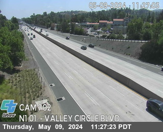


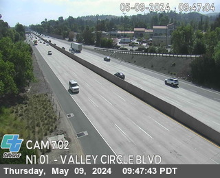
District: 7 Camera ID: 702
Location: US-101 : Valley Circle Blvd
View on Google Maps
Direction: North
Elevation: 941
Location: US-101 : Valley Circle Blvd
View on Google Maps
Direction: North
Elevation: 941
I-405 near Van Nuys in Los Angeles County
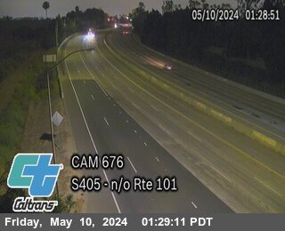


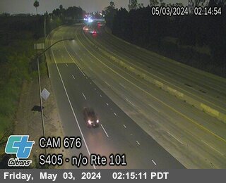
District: 7 Camera ID: 676
Location: I-405 : North of US-101
View on Google Maps
Direction: South
Elevation: 685
Location: I-405 : North of US-101
View on Google Maps
Direction: South
Elevation: 685
US-101 near Encino in Los Angeles County
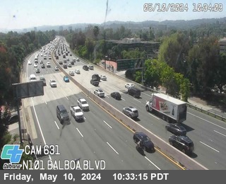


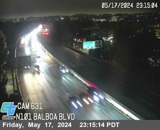
District: 7 Camera ID: 631
Location: US-101 : Balboa Blvd
View on Google Maps
Direction: North
Elevation: 748
Location: US-101 : Balboa Blvd
View on Google Maps
Direction: North
Elevation: 748
I-5 near Burbank in Los Angeles County


SR-118 near Pacoima in Los Angeles County


District: 7 Camera ID: 68
Location: I-5 : East of SR-118 Connector
View on Google Maps
Direction: North
Elevation: 990
Location: I-5 : East of SR-118 Connector
View on Google Maps
Direction: North
Elevation: 990
SR-118 near San Fernando in Los Angeles County


District: 7 Camera ID: 692
Location: SR-118 : North I-5 Conn / Loc 3
View on Google Maps
Direction: West
Elevation: 1003
Location: SR-118 : North I-5 Conn / Loc 3
View on Google Maps
Direction: West
Elevation: 1003
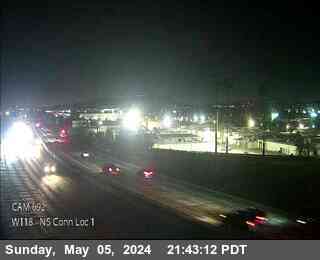
SR-118 near San Fernando in Los Angeles County
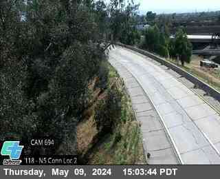


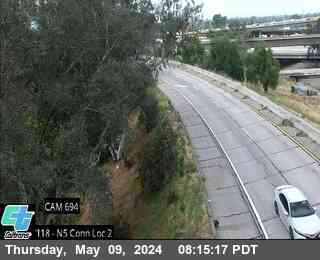
District: 7 Camera ID: 694
Location: SR-118 : North I-5 Conn / Loc 2
View on Google Maps
Direction: West
Elevation: 1007
Location: SR-118 : North I-5 Conn / Loc 2
View on Google Maps
Direction: West
Elevation: 1007
SR-118 near Simi Valley in Ventura County
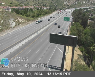


District: 7 Camera ID: 698
Location: SR-118 : Keuhner Dr
View on Google Maps
Direction: East
Elevation: 1108
Location: SR-118 : Keuhner Dr
View on Google Maps
Direction: East
Elevation: 1108